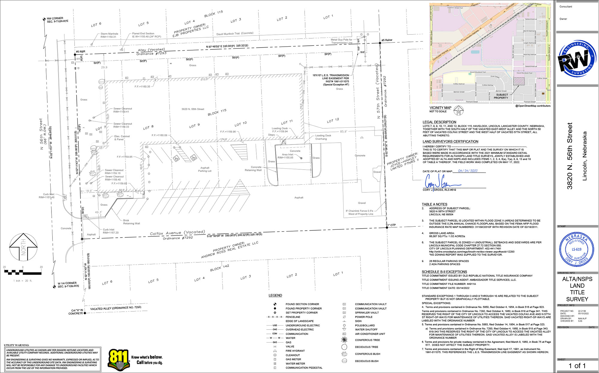
ALTA/ACSM SURVEY
If you need an ALTA/ACSM Land Title Survey (ALTA Survey), trust the professionals at RW Engineering & Surveying to get it done right, on time, and on budget. If you’re not sure if you need an ALTA survey please give the information below a quick read.
What is an ALTA/ACSM Land Title Survey?
An ALTA is a boundary location showing improvements and other elements impacting the ownership of the parcel of land in relation to the parcel boundary. Improvements can consist of buildings, parking lots, utilities, vegetation or other man made improvements. Other elements can consist of utility easements and floodplain areas.
ALTA is the acronym for American Land Title Association. ACSM is the acronym for American Congress of Surveying and Mapping. The American Land Title Association (ALTA) and the American Congress of Surveying and Mapping (ACSM) have jointly developed a set of surveying standards with the goal of promoting uniformity of survey information.
Every ALTA Survey is expected to meet minimum standards as set forth by the American Land Title Association. The one aspect where an ALTA survey can differ from another is the Table “A” options. As stated in the manual for ALTA Surveys, Table “A” is an “Optional Survey Responsibilities and Specifications” checklist. Every parcel of land is different and those differences dictate the information required on an ALTA Survey. The Table “A” is a list of customizable items the end user can choose to include or not include on an ALTA Survey. See example of an ALTA Table “A” by clicking the link at the bottom of this page.
Why do you need an ALTA survey?
ALTA surveys are commonly used in the transfer of commercial property. The ALTA survey provides the title insurance company with information required to insure the title is free and clear encumbrances and provide a certificate of title insurance to the lender. An ALTA survey contains stringent requirements to satisfy the needs of lenders, title companies and parcel owners all on one document. The completed ALTA survey is provided using a plat or map and is provided to the lender, title company and parcel owner.
An ALTA Survey includes six components. These are in order:
- Title Commitment – Provided by the title insurance company to the surveyor.
- Legal research – The surveyor will compile recorded documents such as deeds, plats and easements as filed at the county recorder using the title commitment.
- Field work – The surveyor will gather physical evidence at the project site. The surveyor will visit the site of the ALTA survey and search for and collect the location of found metal corner monuments as well as note the missing corner monuments. The location of improvements such as buildings, parking, vegetation and utilities will also be collected.
- Calculations – The surveyor will compute and reconcile the differences between found evidence and recorded evidence and compute the parcel boundary, much like piecing together a puzzle.
- Field work – The surveyor will set any missing corner monuments for the parcel boundary.
- The completed ALTA survey is provided using a plat or map and is provided to the lender, title company and parcel owner. The plat or map will show the parcel boundary, improvements, easements, floodplain, etc.
What do I get when I hire a Professional Land Surveyor to perform an ALTA survey?
An ALTA survey must conform to a set of standards as dictated by the American Land Title Association. Because every parcel of property is different, an ALTA survey can be customized to meet the needs of the property as well as the information required by the lender and title insurance company. Each ALTA survey is different and the finished plat drawing will be different but the underlying standards of quality are the same, regardless of the informational needs of the lender and title insurance company. The plat map provided to the client must be completed under the direction of and signed by a licensed Professional Land Surveyor. If you need an ALTA survey please contact the professionals at RW Engineering and Surveying.

