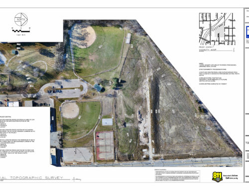
In the early Spring of 2022, RW was approached about surveying the Deer Creek Player’s Club property. The catch was that the purchase date of the property was rapidly approaching, and the survey would need to be completed and delivered in a matter of weeks. With the sheer size of the area in question (over 600 acres), there was only one way to complete the request on time and within the allotted budget. Upon consulting with our client, we came up with a workflow to utilize both our FAA certified drone pilots as well as our licensed land survey team. We threw the book at this one… Our survey team worked to accurately locate the boundaries for hundreds of lots across the entire golf course property. Our drone team worked in tandem with the surveyors to run programmed flights to capture high-resolution aerial photographs of the golf course. By working together, these teams were able to seamlessly combine these two datasets. In the end, we were able to provide our client with super high-resolution PDFs with surveyed boundaries, easements, and every square inch of the site shown in high definition. All on time and in accordance with NSPS/ALTA standards.